

Storm Austen named as strong winds and heavy rain head for the South West
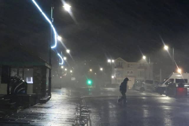

The Met Office has named Storm Austen, warning of gusts in excess of 70mph and 20-30mm of rain in the South West from late Thursday.
Storm Austen, the first named storm of the season, is expected to bring disruptive wind and rain to the South West from late Thursday.
The Met Office named the system today (Tuesday, October 20), warning that gusts in excess of 70mph are possible on the most exposed coasts as an area of deepening low pressure sweeps in from the Atlantic.
A yellow warning for wind has been issued for southern parts of England and south Wales on Friday, October 23. It highlights the chance of travel disruption, power cuts and injuries from flying debris in places.
Tom Crabtree, the Met Office’s Deputy Chief Forecaster, said the exact path of the storm was still being worked out, but the risk was already clear enough to give it a name.
“While the exact track and position of Storm Austen is still being determined, what’s clear is that we have an impactful period of weather on the way and the potential for disruption in places, which has resulted in the system being named,” he said.
“Peak gusts in excess of 70mph are possible on the most exposed coastal areas, while 50-60mph are likely more widely within the warning area. Weather warnings are under constant review and could be updated as confidence increases, so it’s important to stay up-to-date with the forecast in the coming days.”
The Met Office said the low-pressure system forming in the Atlantic would “rapidly deepen” as it was invigorated by the jet stream. After spells of rain and showers on Tuesday and Wednesday, the focus will shift to the south-west of the UK late on Thursday as the storm begins its approach.
It will then move from west to east through Friday, with winds generally diminishing later in the day. Rain is an additional hazard. The Met Office said 20-30mm was expected in many places, with higher totals possible over higher ground in the west and further north on Friday.
“A degree of caution”
For some in the South West, the storm will not have come as a complete surprise.
UK Weather Chase, a group of storm chasers who monitor weather models and track developing systems, issued its own Storm Watch on Saturday (October 17), three days before the Met Office named the storm.
Sam Whitfield, a Field Weather Expert with the group, said the signs first appeared last Thursday (October 15).
“We first started seeing a trend towards a deep area of low pressure developing on Thursday last week,” he said. “However, when a system is still several days away, you have to treat the forecasts with a degree of caution, as the track and intensity can change significantly.”

As the group kept monitoring the latest charts and comparing different weather models, the picture sharpened.
“It became increasingly clear by Saturday that there was growing agreement on a significant low-pressure system moving towards the UK,” Sam said. “At that point, we made the decision to issue our own Storm Watch, signalling the early stages of preparation for potential activation of our storm-chasing operations and alerting people to the possibility of disruptive weather.”

Cornwall and Devon
Asked which parts of Devon looked most at risk, Sam said it was too early to give a firm answer.
“At this stage, I think Cornwall could see some of the most significant impacts, particularly along the west Cornwall coast and other exposed areas,” he said. “However, the precise track of the low-pressure system will be crucial in determining which areas experience the strongest winds and most disruptive conditions.
“For Devon, the risk will depend heavily on how the system develops and moves. We’ll be keeping a close eye on the latest forecasts as the picture becomes clearer.”
That uncertainty matters. A small shift in the storm’s path could mean the difference between a blustery night and widespread disruption, and forecasters say they will not know until nearer the time.
Great Western Railway and Network Rail have been contacted in relation to their preparations.
Coasts and trees
Sam said coastal communities could be particularly vulnerable, especially if high tides and large waves coincide with the strongest winds.
“Exposed coastlines may experience dangerous conditions, with the potential for overtopping, coastal flooding and damage in the most affected locations, depending on the storm’s track and severity,” he said.
He also pointed to the state of the countryside after the recent dry conditions.
“Trees may still be carrying their leaves, which can increase wind resistance, and some trees may be more vulnerable to being brought down in strong gusts,” he said. “Fallen trees and branches could cause disruption to roads and infrastructure.”
Predicted tide times show the highest tides at Bideford, Plymouth and Paignton on Thursday and Friday come in the afternoon, and each is higher on Friday than on Thursday. The Met Office has said Storm Austen will move from west to east through Friday, with winds generally diminishing later in the day. It has not said exactly when the strongest winds will reach each part of Devon.
Predicted tides on Thursday, October 22 (all times BST):
Bideford: high tide at 3:48am (3.6m), low at 10:24am (0.1m), high at 4:06pm (4.3m) and low at 10:50pm (0.1m).
Plymouth: high tide at 3:31am (4.4m), low at 9:31am (2.1m), high at 3:47pm (4.8m) and low at 10:02pm (1.8m).
Paignton: high tide at 4:15am (2.72m), low at 10:14am (1.25m), high at 4:30pm (2.98m) and low at 10:42pm (0.88m).
Predicted tides on Friday, October 23:
Bideford: high tide at 4:31am (4.3m), low at 11:08am (0.1m), high at 4:47pm (5.0m) and low at 11:31pm (0.1m).
Plymouth: high tide at 4:21am (4.8m), low at 10:25am (1.7m), high at 4:35pm (5.1m) and low at 10:51pm (1.4m).
Paignton: high tide at 5:11am (3.03m), low at 10:55am (0.91m), high at 5:22pm (3.28m) and low at 11:17pm (0.53m).
Tide times: BBC (Bideford and Plymouth) and Tide-Forecast.com (Paignton). Heights are not comparable between towns.
Comparisons
Asked whether anything about the storm surprised him, Sam explained its potential to become a significant system stood out, and drew an early comparison with a storm the South West has recent memory of.
“At this stage, what stands out to me is the potential for this system to become a significant storm, with some similarities to Storm Goretti in terms of the level of concern it could generate,” he said. “However, it’s important not to draw comparisons too early, as the eventual impacts will depend on the storm’s final track, intensity and the areas most exposed to the strongest winds.”
Storm Goretti hit the UK on Friday, January 9, 2026.
What next
The Met Office said Storm Austen’s influence would wane late on Friday as it moves into the North Sea, but further periods of wind and rain were likely through the weekend and into the start of next week, with the heaviest rain more likely in western areas.
Sam’s advice was simple. “The key message is to stay weather-aware, follow the latest forecasts and heed any official warnings,” he said. “The Met Office has named the storm Storm Austen, and it’s always better to be prepared than caught off guard.”
Storm Austen is the first name on the 2026/27 list. It was put forward by Irish weather service Met Éireann, which chose it to mark its 90th anniversary and to honour Austen Nagle, the first director of the Irish Meteorological Service. The next name on the list is Boelo.