

The forgotten streams that shaped Torquay, and why they still matter today

From sacred wells to hidden waterways beneath the town centre, Torquay’s streams helped build the town we know today. Historian Dave Thomas explores the forgotten water sources that powered Torquay’s growth, and asks whether it is time to reconnect with them.
A good time to remember Torquay’s three streams? All communities need water; for drinking, cooking, agriculture, hygiene, commerce and transportation. Access to water decides where a community begins and if it thrives. Torquay was no exception and we have three main water sources to thank for the bringing together of scattered farming and fishing hamlets to create the richest town in the nation. Let us begin with a crucial water source for a small community, a sacred well beneath a craggy tor, around which a medieval village steadily grew to become a town. The original name for this holy site was St Petrox well.
The saint lived between c 468 and c 564 and ministered to the Celtic Dumnonian Britons of Devon and Cornwall. This has been taken to indicate that Torre’s church, probably a wooden chapel, dates back to the late sixth century. Both Celt and Saxon were very aware of the hazards of locating their settlement too close to the sea. In addition to protection from the elements and flooding, passing pirates and slavers were forever looking for easy prey. It was wiser to build inland, where a village was less likely to be seen or surprised by a landing party. Perhaps it was the coming of the railway in 1859 that diverted the subterranean flow, or the construction of buildings nearby. Whatever the cause, the well dried up in around 1860. Our second water source is the Scire Brook, from the Old English word scire, clear, and broc, flowing stream. It rises in a valley with a natural spring, a wielle, with clear water. We now know it as Sherwell. In 1196 the men that planned the future Torre Abbey needed a reliable water supply and chose the location carefully. For 340 years the Scire was then utilised for the ponds and mills of the richest Premonstratensian foundation in England.
After Henry VIII closed the Abbey in 1538 such skill management of the water supply was no longer needed and so the Scire gradually reverted to its original route to the sea. During the nineteenth century, however, Torquay found itself being embarrassed by the stream’s long neglect. Since Torquay’s Railway Station was built in 1859, the vast majority of visitors came by rail to the nation’s premier resort. It was then just a short and scenic trip by carriage to all those fine hotels … and that is where the source of the town’s shame was to be found. All would be well if passengers looked to their right to gaze across the Bay. However, if they glanced to their left they would see Donkeyland, “A receptacle for all manner of rubbish, ‘mid which grew rank thistles to feed a fat and supine ass, who occupied the grounds for many years”. Through this uninspiring landscape, “a turbid stream meandered along its bestrewn channel, and all around were evidences of depressing neglect.” This got worse if tourists enquired after the name of the old road that ran alongside the Abbey. They would reluctantly be informed that this ancient causeway was called Rotten Row, likely after the rats that were to be found there. This humiliation needed to be sorted out and in 1877 the boundary wall between the Abbey grounds and Rotten Row was erected and the road raised several feet to its current elevation. A new and more exclusive name was adopted: King’s Drive, later named after Edward VII. These acquisitions allowed the creation of a relatively recent innovation, a public park.
Alongside the greensward of the Abbey’s Meadows were constructed two concrete lakes, divided by a rustic bridge, the smaller lake with an island for ducks and the larger for juvenile Walter Raleighs to sail their pocket yachts. How the resident fowl were meant to restrict themselves to their allotted territory beyond the bridge was never explained. Our third water source is the Fleet. It takes its name from ‘flēot’ meaning ‘tidal inlet’ even though the Flete Brook actually rises far inland in Combe Pafford. After flowing south through Upton, the Fleet turns southeast to funnel through a narrow limestone valley bounded by Torre and Waldon Hill to the south, and Furze and Braddon Hills in the north. Long confined underground, the Fleet concludes its journey unseen at the harbour. The first mention we have of the Fleet is in the 1556 will of Symon Wheler of Torre which bequeathed “all my salt in my cellars at Flyett”. In 1608 we have records of a grant of land “and another house and dye mill lately erected and built by the said John Saunders at Fleete within the tithing of Tormohun”. Going further back, it is believed that the Fleet was being utilised to grind corn at the Fleet Mill by the end of the thirteenth century. This site of the mill was at the bottom of Union Street, near where Primark now is. The mill was demolished in 1835, but we do have a late eighteenth-century watercolour painted by the Reverend JB Swete. It shows the mill with a waterwheel in a steep valley with cows grazing in the foreground; the mill pond was in Pimlico.
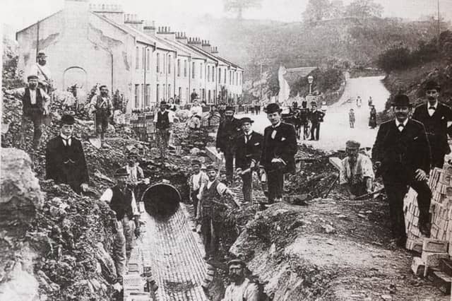
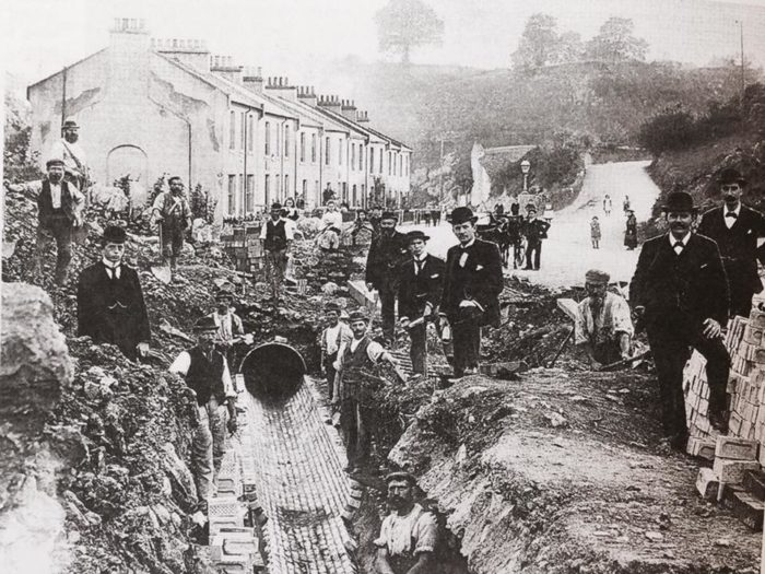
That bucolic scene would change during the nineteenth century when the vale sustained extensive quarrying to cater for Torquay’s swift expansion. Over the years the landscape through which the stream flowed has changed significantly. Alongside extensive limestone quarrying which widened the valley, the Fleet was culverted allowing for building and by the late eighteenth-century, the long tidal inlet had been tamed and reclaimed. As a source of drinking water, the Fleet and its tributaries such as Ellacombe’s brook were crucial to Torquay’s development. But the Fleet also took sewage out to sea via the harbour and so carried disease. In 1832 and 1849 cholera reached Torquay. The latter outbreak lasted for six weeks leading to 66 deaths mainly in the oldest and impoverished parts of town, Pimlico, Swan Street and George Street. A growing awareness of the dangers of such waterborne diseases caused Torquay to adopt the Public Health Act, the first meeting of the Local Board of Health taking place in September 1850. Conditions then gradually began to improve, with the Board making “a good wide street between the bottom of Union Street and the Strand” to replace the narrow alleyways on both sides of the Fleet. At the same time, the river was confined to a tunnel which from then on flowed unseen towards its ultimate destination, the Strand, from the Old English strond meaning sea shore. Today, the Fleet remains underground, and the broad highway still runs through Torquay from Castle Circus to the harbour.
Though you can’t see it, you can often hear the Fleet rushing below you if you stand outside Primark. But never forget that the mother of Torquay also has a temper. While normally serene and discrete, high tides and heavy rain on many occasions brought her waters to street level. This required the construction of storm tanks to cope with town centre flooding. Torquay’s watery triptych was therefore essential in the making of the modern town. Each stream carved the landscape, was utilised by many generations; but when no longer of use, their flows were destroyed, forced underground or simply forgotten. But now climate change is making weather less predictable with long dry spells and water shortages more common. The Bay’s population will continue to grow, with tourism adding to demand, and so is now the time to ask whether we should continue to lose millions of gallons of fresh water to the sea. Or should we relearn our respect for Torquay’s remaining water sources in order to irrigate our parks and gardens and so preserve and maintain our vibrant green landscape?